Land Surveyors
Advertisement
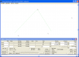
Copan Pro v.11 11
Copan Pro -- for Windows 98, NT, 2000, ME, XP, Vista, or 7 -- is a very functional and easy-to-use desktop/netbook geomatics engineering tool for computing and managing plane land surveying and mapping coordinates, and drafting survey maps and plans.
Advertisement
Copan for Windows v.10 9
Copan for Windows desktop/netbook is a very functional and easy-to-use geomatics engineering tool for computing and managing plane land surveying and mapping coordinates. It does numerous coordinate geometry (COGO) calculations, processes and
InfoMate v.3 1
InfoMate is a complete survey computation, fieldwork reduction, data capture and translation environment, aimed at Local Government, Land Surveyors, Municipalities and the GIS community.
Copan for PocketPC v.1.0.7
Copan for Pocket PC is a very functional and easy-to-use geomatics engineering tool for computing and managing plane surveying and mapping coordinates. It does numerous coordinate geometry (COGO) calculations, processes and adjusts raw field survey
Copan for Mobile v.1.0.7
Copan for Mobile 6 is a very functional and easy-to-use geomatics engineering tool for computing and managing plane surveying and mapping coordinates. It does numerous coordinate geometry (COGO) calculations, processes and adjusts raw field survey
CopanMobile for PalmOS v.1.0.3
CopanMobile for Palm OS is a very functional and easy-to-use geomatics engineering tool for computing and managing plane surveying and mapping coordinates. It does numerous coordinate geometry (COGO) calculations,
CopanMobile for PocketPC v.1.0.2
CopanMobile for Pocket PC is a very functional and easy-to-use geomatics engineering tool for computing and managing plane surveying and mapping coordinates. It does numerous coordinate geometry (COGO) calculations,
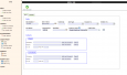
IPJC v.0.5
iPJC is an easy-to-use record keeping system for the land surveying industry. It allows your staff to securely store, retrieve and cross-reference all of your company's survey database records -- of estimates, plans,
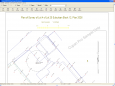
DXmQuattro v.5.0
The software can create plans, cross sections, 3D views and overlay models on a georeferenced image. The image might be an an aerial photograph with the ground model countours superimposed on it making it easier for clients to understand.
Terrain Tool for AutoCAD v.1.2
Terrain Tool offers a strong way of designing, analyzing and presenting terrains in AutoCAD. It was developed with the needs of architects and landscape architects in mind.

Danzania - Land of Wonder Screensaver
King Danxii III rules in the mythical comedic country of Danzania at www.danzania.pixelparadox.com. You will be thrilled by his magnanimous generosity in offering you his FREE animated 3D screensaver as a souvenir of your visit to Danzania - Land of